SEE YOUR BUILD —
WITHOUT BEING THERE
Construction moves fast. Budgets are tight. Teams are remote. And traditional updates — text reports and random photos — don't provide clarity.
Flylisted delivers structured, monthly visual documentation for each site so you can see real progress instead of guessing.
REQUEST A DEMO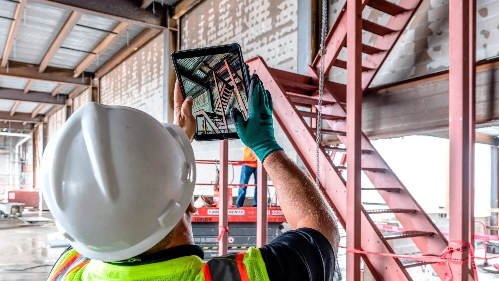
We combine:
- Ground and Aerial Photography
- Video Walkthroughs
- 360 Walkthroughs
- Drone Scans and Mapping
into one clean monthly visual report per site — ready to review or share.
The Problem
OLD SCHOOL TRACKING CAN'T KEEP PACE
WITH MODERN PROJECTS
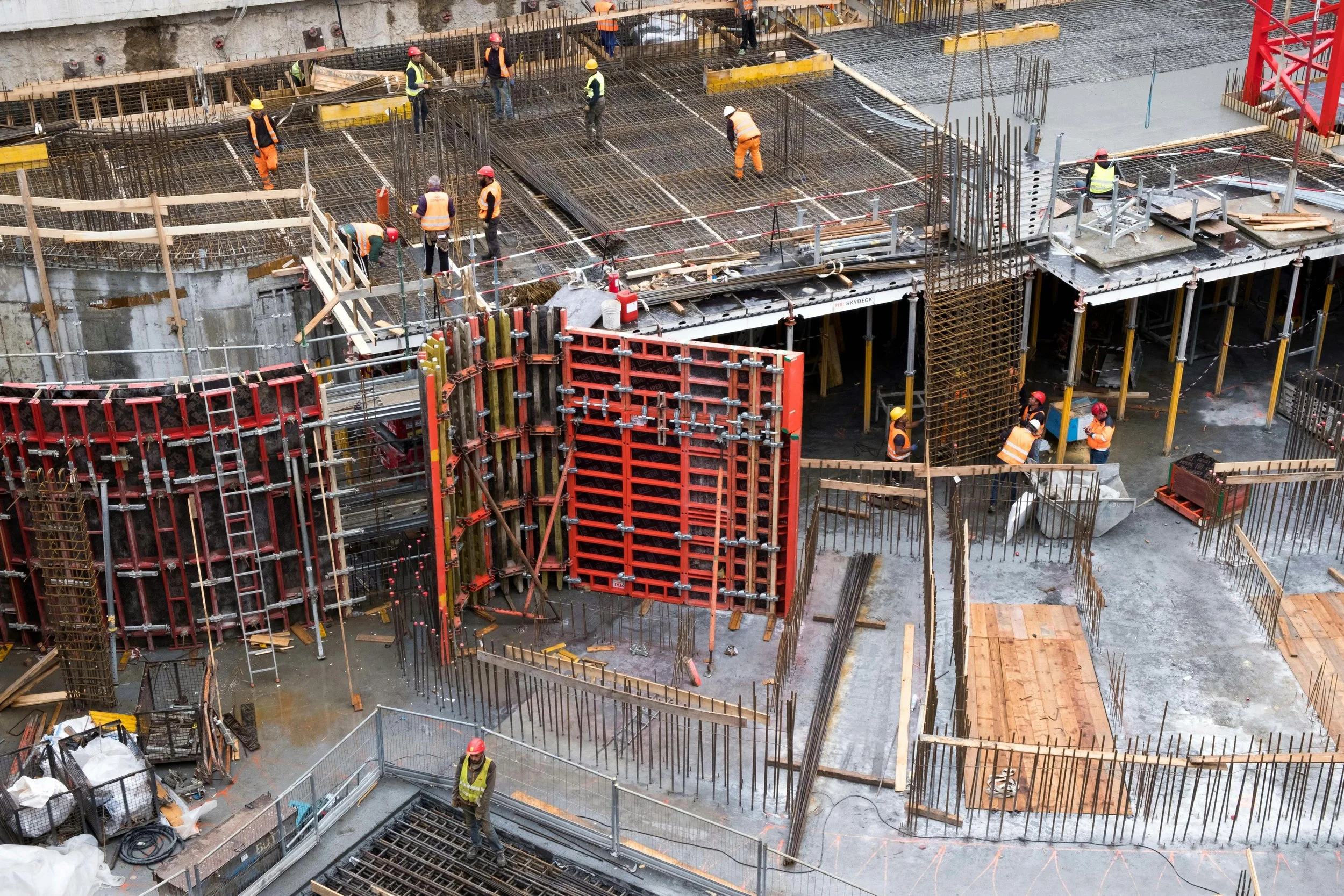
Construction companies struggle with one consistent problem: a lack of clear, reliable visibility across their jobsites. Progress updates are often pieced together from scattered photos, inconsistent reports, and occasional site visits, leading to miscommunication, delayed decisions, unnecessary travel, and costly rework. When stakeholders aren't aligned on what's actually happening in the field, small issues go unnoticed until they become expensive problems. Flylisted solves this by delivering structured, monthly visual documentation per site—creating a clear, shared source of truth that reduces confusion, speeds up decisions, and keeps projects on track.

Review progress without site visits
A picture is worth a thousand words — but a consistent series of pictures month after month is worth thousands saved in time and travel.

Share clarity with stakeholders
Send visuals that speak for themselves. No explanations. No confusion.

Reduce rework and avoid miscommunication
Everyone sees the same reality at the same time.

Improve forecasting and planning
Visual momentum reveals scheduling trends before they become delays.
The Solution
A CLEAR, VISUAL SOURCE OF TRUTH —
EVERY MONTH
Designed to be simple, repeatable, and scalable, Flylisted documents your project from above and on the ground, turning complex construction into simple, visual insight.
Reduction in Site Visit Costs
Fewer Change Orders Caused by Miscommunication
Less Time Spent Creating Progress Reports
Reduction in Project Delays
How it Works
OUR SERVICES
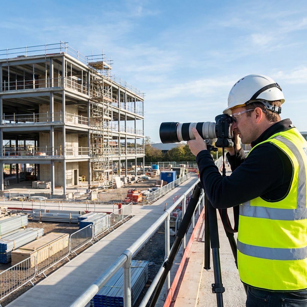
Photography
Ground and drone photographs provide a comprehensive presentation of all aspects of your job, big and small. Plus, our photos are designed to document the progress and changes on site as they develop, so you can always compare and reference decisions from older dates at the same location.
Videography
Quick and identifiable clips of the site show how different parts of the project connect, and can synthesize a site visit into an easy-to-deliver format for stakeholders.
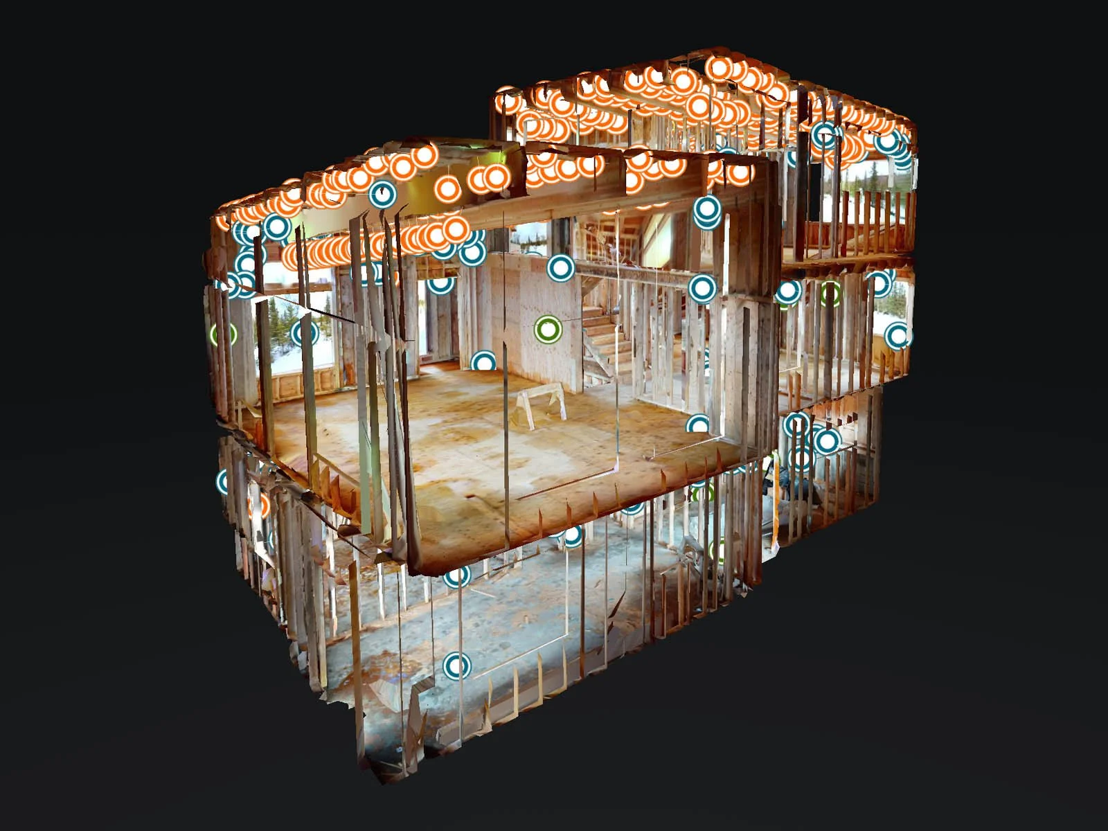
360 Walkthroughs
A digital site visit, tour through our 360 degree model of your site. You can markup points of interest, calculate measurements, and train team members without the trip.
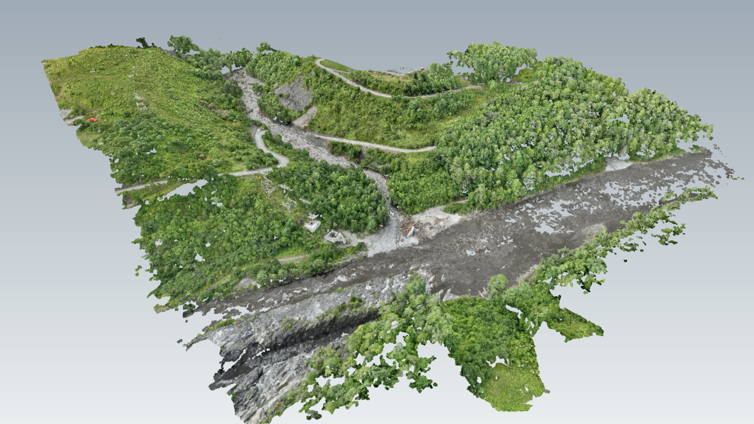
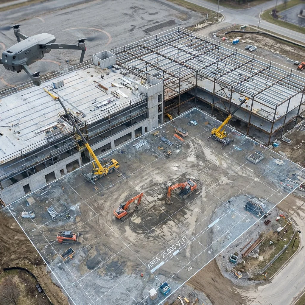
Aerial Scanning
State of the art models, images, and mapping software allow you to visualize your jobsite unlike ever before.

A Clear, Visual Source of Truth—Every Month
Flylisted documents your project from above and on the ground, turning complex construction progress into simple, visual insight.
TRUSTED BY DEVELOPERS, ARCHITECTS, AND PROJECT TEAMS WHO VALUE
CLARITY OVER CHAOS
Used on projects across residential, commercial, and mixed-use developments.


Pricing
Choose Your Level of Insight
Clear documentation. Clean delivery. No noise.
Perfect for teams who want reliable monthly visibility without complexity.
- Up to 50 jobsite images
- Up to 30 video clips
- Aerial photography and videography
- Organized file delivery
Progress you can walk through—without stepping on site.
Adds spatial awareness and deeper context to your monthly updates.
- 3D walkthrough tour of the site
- Up to 10 360° camera scans
The complete visual intelligence layer for your project.
Built for developers and teams who want total clarity and professional presentation.
- Up to 70 images
- High-resolution orthomosaic aerial map
- Elevation point cloud data
- Monthly edited video reel
- Branded graphics for presentations

Designed For Teams Who Can't Afford Blind Spots
- Developers managing multiple projects
- Architects coordinating with contractors
- Owners reporting to investors
- Project Managers who need clarity without travel
Why Flylisted Is Different
Built specifically for construction progress, not marketing fluff

Consistent, repeatable documentation month after month

Visuals designed to communicate, not impress

Clean delivery your stakeholders actually understand
FAQ
No. That's the point.
Yes. Everything is delivered clean, professional, and presentation-ready.
Custom coverage and additional visits are available.
No. It's structured progress tracking designed for decision-making.
See Your Project Clearly—Every Month
Stop relying on updates that leave more questions than answers. Flylisted gives you confidence, clarity, and control—without stepping on site.