
Drone orthomosaics for land development: accurate site mapping
Orthomosaics give developers precise, georeferenced site maps in a single capture. Learn how drone imaging replaces traditional surveys for faster, cheaper planning.
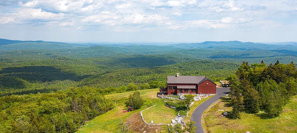
An orthomosaic is a geometrically corrected aerial photograph. Unlike a regular drone photo, every pixel in an orthomosaic is perfectly aligned to true coordinates on the ground. For land development, that means you get a map-grade image you can measure directly, overlay with CAD files, and hand to engineers without follow-up surveys.
Developers and site planners have relied on surveyors and satellite imagery for years. Both work, but both come with lag time and cost. An orthomosaic from a drone sits between those options: fast enough to turn around in days, precise enough to guide design, and affordable enough to run multiple iterations as a project evolves.
What an orthomosaic does
A drone captures 100 to 200 overlapping photos of a site from a planned flight pattern. Software stitches those photos together and then applies ground-control corrections (GPS points and local reference data) to remove tilt and scale distortion. The result is a single, seamless aerial image where north is up, distance is true, and elevation differences are visible.
You can measure property lines, existing structures, vegetation, grade breaks, and drainage patterns without ever setting foot on the lot. Engineers can overlay survey data, utility maps, and preliminary site plans directly into the orthomosaic. Planners can count trees, estimate fill and cut, and identify site constraints before the first equipment arrives.
Speed and cost versus traditional survey
A land survey by a licensed surveyor takes 5 to 10 business days and costs 2,000 to 8,000 dollars depending on site size and complexity. You wait for the fieldwork, then the office work, then the report.
A drone orthomosaic takes one flight and one to three days of processing. For a single site, the cost is a fraction of a full survey. If you need multiple updates as the design changes (property acquisition, phasing adjustments, contractor feedback), additional orthomosaics cost far less than new surveys.
That speed matters. A developer can validate site feasibility, test multiple site plans, and get buy-in from municipal reviewers faster. Contractors see accurate grading data before they mobilize.
Accuracy and limits
An orthomosaic is not a replacement for a professional boundary survey. If your project requires certified property lines, easement locations, or deed boundary verification, you still need a licensed surveyor.
What an orthomosaic does well is give you spatial truth for planning. Existing site features, topography, building footprints, and infrastructure are captured and georeferenced. The imagery is accurate enough to guide design decisions and catch conflicts before they become expensive.
Weather and canopy density affect image quality. Dense trees hide terrain. Cloud cover means rescheduling. But for open land, partially cleared sites, and developed parcels with sparse vegetation, orthomosaics deliver clear, actionable data.
Workflow integration
The orthomosaic lands as a georeferenced image file (GeoTIFF format) compatible with GIS, CAD, and design software. Your team imports it into existing tools. Engineers overlay boundary data, utilities, and design geometry directly into the ortho. Contractors see existing conditions at true scale.
Rev the design. Run a new flight. Get an updated orthomosaic. The cycle is short and the feedback loop is immediate. No waiting for survey revisions or paying for multiple professional surveys.
When to use one
Use an orthomosaic for any land project where you need fast, accurate site mapping without professional boundary certification. Subdivisions. Multi-family site plans. Mixed-use development. Industrial park layouts. Residential lot configuration. Preliminary phase planning before acquisition closes.
Use one before hiring a surveyor if the project is still in concept or option phase. It answers the feasibility questions cheap and fast. Once the design is locked and you're ready to permit, bring in the surveyor for formal boundary and utility certification.
The practical outcome
You get a single image that shows existing conditions, true ground scale, and spatial relationships. Your team sees the site in one view. Engineers have measured data without the turnaround time of traditional survey. Planners can test configurations and show clients/municipalities what fits.
For a development team, that translates to faster design cycles, lower pre-development cost, and fewer surprises when the real work starts.
Flylisted operates under FAA Part-107 certification and delivers orthomosaics across New England and South Florida. The standard turnaround for site imagery and processing is one to three days after the flight.
Start with an orthomosaic if you need accurate, fast site mapping for development planning. Visit our drone services page to request a quote for your project.